
The first project is the East Somerville Community Mapping Project. I hope that it will inspire you. If you are involved in a project or know of one, let me know.
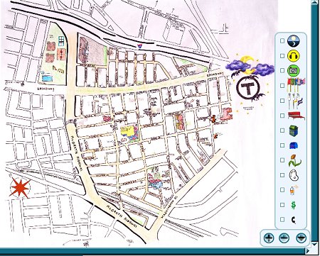
This is a community map of East Somerville, located just northwest of Boston. Where are the community gardens? Do the bus stops have benches or shelters? What intersections have more foot traffic at different times in the day? Take a look at East Somerville through the eyes and ears of people who live here.
Learn more about the East Somerville Community Mapping Project
Mike Meuser
GIS Project Development, Data Research and Custom Shapefile Creation
Free GIS Software, Shapefiles, Maps and Tutorials
Free GPS, Aerial, TOPO Maps and News
If you have data, GIS project or custom shapefile needs send me an email
Premium Shapefiles: ZipCode, Indian & Federal Lands, School Districts, Tornadoes, Dams, Climate Change & Global Warming


No comments:
Post a Comment