
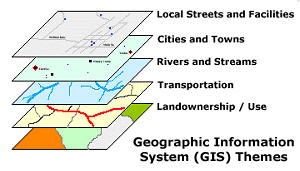
GIS is used to display and analyze spatial data which are tied to databases. This connection is what gives GIS its power: maps can be drawn from the database and data can be referenced from the maps. When a database is updated, the associated map can be updated as well. GIS databases include a wide variety of information including: geographic, social, political, environmental, and demographic.
Read full article at MapCruzin.com

