Friday, May 14, 2010

Download Free United States 80 Meter Green Renewable Wind Energy Maps by State

Maps of available wind energy at 80 meters above ground. The zip files include high resolution JPG images and PDFs of the map and chart plus a state-by-state XLS spreadsheet showing available wind energy, capacity installed and energy produced.


Download 80 Meter Wind Energy Potential Maps

Monday, May 10, 2010

United States Green Renewable Wind Energy Maps by State on Flickr.com

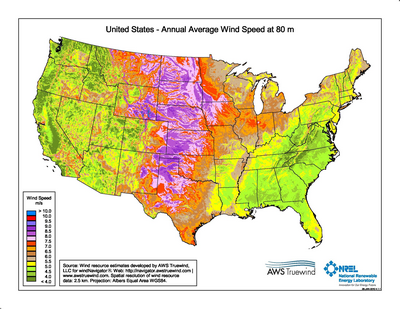
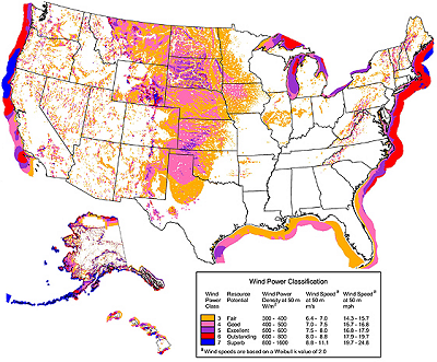
Our United States Green Renewable Wind Energy Resource Potential Maps by State are now on flickr.com in a variety of sizes for you to view or download. The wind for these maps is measured at 50 meters above ground.


More of our maps are being added to flickr.com on an ongoing basis so be sure to check MapCruzin.com Maps at Flickr.com