
Drought maps of the entire U.S. and by region or state are now available here. These maps are updated every few days.
Saturday, November 16, 2013
Thursday, November 7, 2013
New Iran Shapefiles - Download Free
Hi - just uploaded the following Iran shapefiles for you to download:
Admistrative boundaries
Highways
Points of interest
Natural features
Railways
Roads
Water features
Waterways
Places
Download these free shapefiles at www.mapcruzin.com/free-iran-arcgis-maps-shapefiles.htm.
Download Free Brazil Shapefile Layers
Hi - just uploaded the following Brazil shapefiles for you to download:
Admistrative boundaries
Highways
Points of interest
Natural features
Water features
Places
Download these free shapefiles at www.mapcruzin.com/free-brazil-arcgis-maps-shapefiles.htm.
Tuesday, September 10, 2013
2012 TRI Toxic Release Inventory - Download Preliminary Data
EPA just released the 2012 Toxic Release Inventory preliminary data set.
You can find the 2012 TRI data here.
Mike
Tuesday, July 2, 2013
Put Your Free Maps, GIS Shapefiles and Software on MapCruzin and Gain More Exposure
Hi - We're always looking for new maps, GIS software and shapefiles to offer to our visitors. If you have free maps and shapefiles you might consider putting them on MapCruzin.com. We'll make separate pages for your material and be sure that there are links to your website and/or blog.
If Interested Contact me and we'll work out the details.
Mike
Tuesday, June 11, 2013
Free MODIS and VIIRS Satellite Active Fire GIS Shapefiles
The USFS provides free GIS shapefiles of their MODIS and VIIRS satellite data. It is available for present and historical wildfires in the U.S.
Sunday, June 9, 2013
Forest Service Active Wildfire Mapping - Drought Info
Well, fire season is upon us. Hard to believe that we had snow and freezing weather just a few weeks ago here in the Sierra-Cascades. Now there are red flag warning over most of Northern California. Dry thunderstorms with lightning forecast this evening and Monday.
The Forest Service Remote Sensing Center provides Active Wildfire Mapping showing wildfires in the U.S. in real-time. They also provide Inciweb for more detailed information and updates on current and recent fires.
I've also provided links to a U.S. drought monitor.
Learn more about wildfires and drought in the U.S.
Stay Safe!
P.S. Last year I bought an older pumper fire truck from a local fire department. Last 3 days have been spent getting it all in top shape for the season - better safe than sorry.
Friday, May 24, 2013
Bridge Collapses in Washington - Get Free Maps of Structurally Deficient Bridges
According to the Huffington Post The I-5 bridge over the Skagit River in Washington collapsed. This bridge is one of hundreds identified as structurally deficient.
View and download maps of structurally deficient bridges in the United States
Wednesday, February 20, 2013
Caliper Releases Maptitude 2013
I've always been a fan of Maptitude. Over time it has proven to be fast, robust, cost effective and includes all sorts of great data. You can read more about why I like Maptitude here.
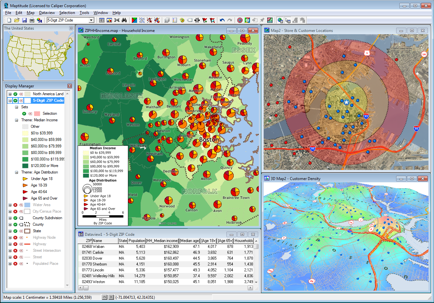
This new release is no exception. I've found it to be faster and even easier to use. I think it is the best GIS going for those new to digital mapping and the more experienced.
Check here to learn about the new features in Maptitude 2013. Learn why, after using Maptitude for nearly 20 years, I still think it is the best.
Mike
Wednesday, February 13, 2013
Maps of Structurally Deficient Bridges - Download Free
In tonight's State of the Union address, president Obama talked about improving and repairing our infrastructure. His primary example was the repairing of our tens of thousands of structurally deficient bridges in the United States.
Download Maps of Structurally Deficient Bridges for Free here.
Sunday, January 6, 2013
TRI Shapefiles Based on 2011 EPA Toxic Release Inventory Dataset
EPA finalized the 2011 toxic release inventory dataset on October 31, 2012. It is 100% complete and will be used for their upcoming national analysis. We have used this dataset to create TRI shapefiles.

Subscribe to:
Posts (Atom)