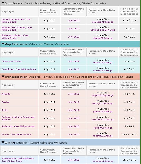
New one million-scale shapefiles are available from the National Atlas team. They include the following categories of shapefiles: U.S. boundaries, map reference, transportation and water. You can download these for free and use them in any manner that you please.
Learn more about the new one million-scale shapefiles


