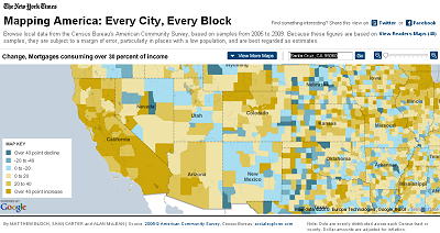
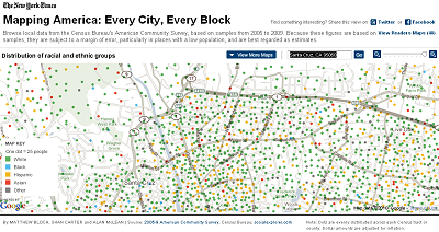
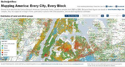
You can browse local data from the Census Bureau's American Community Survey, based on samples from 2005 to 2009. Because these figures are based on samples, they are subject to a margin of error, particularly in places with a low population, and are best regarded as estimates. Here are some examples.
If you are interested in creating your own flashmaps like these, check out
StatPlanet.


Check out
StatPlanet to make your own flash-based web maps.
Free GIS Software, Shapefiles, Maps and Tutorials
Check out the NY Times
Mapping America: Every City, Every Block.


