

Census 2010 Population Change. Click here for larger interactive maps.
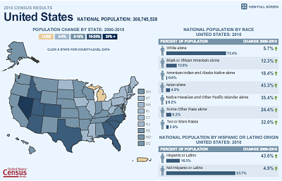
Census 2010 Demographic Change by State. Click here for larger interactive maps.
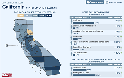
Census 2010 Population and Demographic Change State Maps.
Go To Interactive U.S. Census 2010 Interactive Population and Demographic Change Maps
Mike Meuser
GIS Project Development, Data Research and Custom Shapefile Creation
Free GIS Software, Shapefiles, Maps and Tutorials
Free GPS, Aerial, TOPO Maps and News
If you have data, GIS project or custom shapefile needs send me an email
Premium Shapefiles: ZipCode, Indian & Federal Lands, School Districts, Tornadoes, Dams, Climate Change & Global Warming


No comments:
Post a Comment