I have provided some sample maps. I created these with Maptitude GIS. If you are new to GIS, check out our Learn2Map GIS Tutorial and Atlas, learn more and download a free GIS program that you can use to make your own maps with these shapefiles.

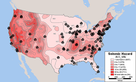
Nuclear Facilities and Seismic Hazard Zones

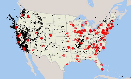
Nuclear Facilities and Historical U.S. Earthquakes

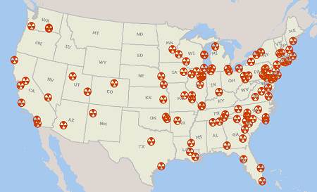
Nuclear Reactors in the United States

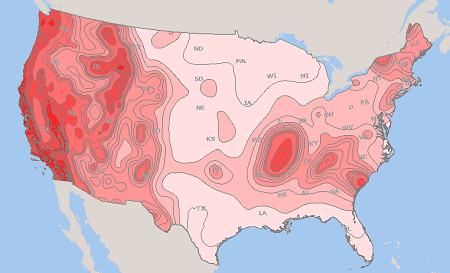
U.S. Seismic Hazard Zones
Download U.S. Nuclear Reactor, Historical Earthquakes and Seismic Hazard Shapefiles


No comments:
Post a Comment